
Walk a Lake Elsinore Street Record
A street-by-street search in Lake Elsinore should begin with the parcel, not an assumed household. The Riverside County Assessor accepts a property address, APN, or assessment number. Map My County then supplies the parcel outline, adjacent parcels, city boundary, and selected planning or permit layers. The Recorder adds party-indexed deeds and liens. City files add project history. A dated reverse directory can show a listed occupant, but it is a snapshot rather than a current roster.
This order gives the address trail a stable path: address to APN, APN to map, map to custodian, custodian to record. Keep a short note for each result. Record whether the name is an owner, grantor, grantee, applicant, contractor, registered voter, or historical occupant. Those roles are not interchangeable, and the source date matters as much as the name.
- Enter the street number and street name in the Riverside County Assessor property search, then save the APN or PIN.
- Open the same parcel in Map My County and identify the target parcel, nearby APNs, municipal line, and useful layers.
- Search the Recorder by party name and likely date, using LAST FIRST MI and both grantor and grantee roles.
- Ask the City for existing permit or code records by address, APN, project number, and date range when no public index answers the question.
- Use the documented Haines reverse-directory years or library resources for a dated occupant clue, then cross-check it.
Lake Elsinore Address Record to APN
The Riverside County Assessor property search is the first working tool in a Lake Elsinore street directory. Its three search modes are Assessor's Parcel Number, Property Identification Number or assessment number, and Property Address. The address mode works best with the street number plus street name, such as a simple number and road name without city, state, or ZIP. The PIN mode uses the first nine digits and leaves out the dash and final digit.
The returned parcel context can carry a situs address, APN or PIN, legal-description or map reference, assessment values, property characteristics, and tax links. The official material does not advertise an unrestricted online owner-name mode. Ownership is available through public-service office computers and microfiche. This is why the street directory starts with a parcel identity and states plainly when a name came from a counter record rather than a web card.
| Search field | Type | Format and purpose |
|---|---|---|
| APN | Text | Use the Assessor's Parcel Number; retain the parcel key for GIS and deed work. |
| PIN / assessment number | Text | Enter the first 9 digits only, without the dash and final digit. |
| Property address | Text | Enter street number and street name; omit city, state, and ZIP in the basic search. |
| Search / Clear | Buttons | Run the selected query or reset before changing modes. |
The Riverside County property search is free for the basic query. Its owner-name limitation keeps a property fact from being overstated as a resident fact.
Note: The Assessor's property search supplies the parcel bridge, while ownership access remains a counter or microfiche question in this jurisdiction.
Address Records on a Lake Elsinore Street
Different custodians answer different address questions. The Riverside County Assessor identifies parcel and assessment facts. Map My County shows geometry and layers. The Recorder indexes documents by party and date. The City can hold permit and planning files inside the incorporated boundary. California voter material is an authenticated or regulated channel, not an open street roster. A useful address directory therefore joins records without flattening them.
| Record set | Keeper | Street-level contribution | Access |
|---|---|---|---|
| Parcel and assessment | Riverside County Assessor | APN, situs, values, and property facts | Address/APN web query; owner route at office |
| Parcel map and layers | Riverside County GIS | Boundaries, adjacent APNs, districts, and selected permit layers | Free Map My County viewer |
| Deeds and liens | County Recorder | Grantor, grantee, document type, date, and legal description | 1974+ web index; copies cost extra |
| Permits and planning | City of Lake Elsinore | Project address, scope, participants, status, and dates when released | CSS or focused public-record request |
| Reverse directory | Libraries and documented source collections | Dated address-to-listed-occupant clue | Edition or library access |
The parcel number is the strongest bridge between these sets. A street name can be formatted in more than one way, and a legal description can outlast a postal label. The chain is useful precisely because each office contributes a different kind of evidence.
Lake Elsinore Address Records Differ
A Lake Elsinore street directory should label three address concepts every time they appear. Situs means the physical parcel location. Mailing means where an owner or tax notice is sent. The legal description means the land described in a deed or recorded map. A fourth label, USPS standardized address, describes delivery format. None of these labels alone states who occupies a building.
That distinction is visible in the Assessor route. The public web search is designed around APN, PIN, and property address, while ownership is expressly available through office computers and microfiche. A mailing address away from Lake Elsinore may indicate an owner, trust, manager, or service address. It does not establish the people at the situs. A homeowners' exemption is also not proof of every current occupant.
- Parcel
- A defined piece of land with a county APN and a map or legal description.
- Situs address
- The physical location assigned to the taxed parcel or building.
- Mailing address
- The destination for assessment, tax, or other correspondence.
- Plat
- A recorded map that can show tract, lot, block, and parcel relationships.
- Criss-cross directory
- A dated reverse directory that may connect an address to a listed occupant or business.
Write the category beside each result. That simple habit prevents an owner name from being presented as a resident name and keeps the source record faithful to the research.
Trace Lake Elsinore Deed Records
Riverside County recorded documents are indexed by parties, not by a complete address roster. Once the APN and current owner are identified through the appropriate Assessor channel, search the Recorder for that person as grantee near the likely acquisition date. Inventory the grantee, grantor, recording date, document number, deed type, and legal description. Then search the earlier deed's grantor as the next prior grantee. Repeat the role reversal until the online cutoff.
The Recorder's web index reaches January 1, 1974. Earlier instruments require office indexes, deed books, microfilm, or staff-assisted retrieval. Clerk documents are indexed from January 1, 1893, but that broader Clerk date does not make it a full pre-1974 deed substitute. Copies can be ordered online, in person, or by mail. The index can be free even when an image or certified copy has a charge.
The Riverside Recorder name-search interface accepts LAST FIRST MI without punctuation, date limits, document types, and advanced name behavior. Use a surname and first initial when middle names vary. Keep document numbers and book-page references with the APN.
| Deed trail field | Why it matters |
|---|---|
| Grantee | The party receiving the recorded interest in the searched transfer. |
| Grantor | The party transferring the recorded interest and the next name to test backward. |
| Recording reference | Document number, date, or book-page key for a copy request. |
| Legal description | The land identity used to check that the chain follows the same parcel. |
Note: Reversing grantee to grantor is a chain-of-title method, but every step still needs the same legal description or parcel check.
Lake Elsinore Permit Records Show Roles
City permits add a different kind of address record. The Citizen Self Service portal supports submissions, status tracking, uploads, payment, collaboration, and applications for Building, Fire, Engineering, and Planning work. The public historical-search coverage is not published, so a street directory should not imply that every permit is searchable online. Use the City's public-record request route for an existing permit file when the portal does not supply it.
The City building-permit application is unusually detailed. It asks for project address, applicant, owner, contractor, architect, permit type, square footage, valuation, project description, trade quantities, date, and electronic signature. The completed PDF must be attached to a CSS submission. Those fields can place a person or business in a dated project role, but release and redaction rules still control the underlying file.
The Lake Elsinore Citizen Self Service portal is the source for submission and tracking details.
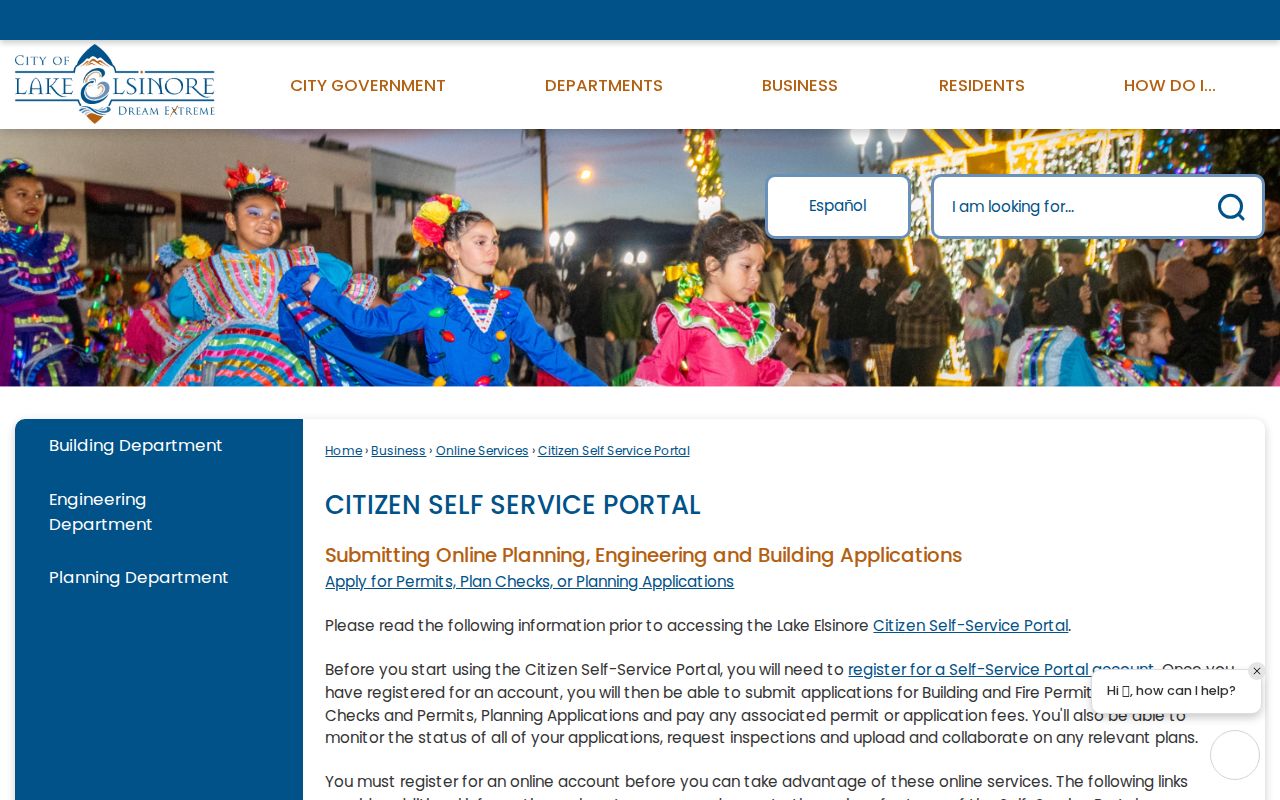
The permit view reinforces the need to name the role shown. An applicant, owner, contractor, and architect can be four different parties connected to one address and one project.
Lake Elsinore Business Address Records
The City staff directory is a public contact directory, not a private resident roll. It can be searched by category, first name, and last name, and a typical result shows name, title, email, phone, additional phone, department address, and hours. It is useful for routing a records request and for confirming a government role. It should not be used to infer a home address.
The separate HdL business-license search asks for a search key, a value, and an optional start-date range. The text interface did not expose all dropdown choices, result fields, historical coverage, or export behavior. A public business location is a commercial clue, not a residence. For a street study, keep business premises, city contacts, and household claims in separate columns.
The City of Lake Elsinore staff directory shows the category and name fields.
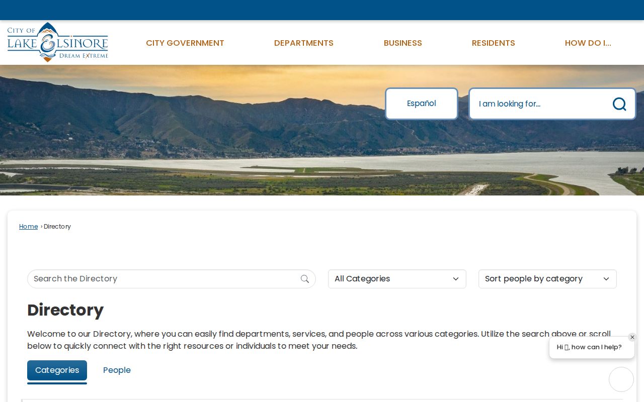
The staff directory is a clean example of a public role list. The address trail remains useful only when the source's purpose is kept intact.
The Lake Elsinore business-license search adds a date-filtered local business route.
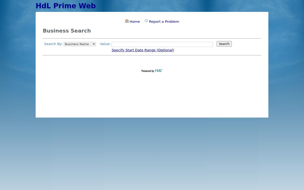
Use a business record to verify a storefront or filing role, not to label a private household.
Lake Elsinore Voter Records by Street
California My Voter Status is not a public street directory. It authenticates the registrant's own record with name, date of birth, and an identifying number or alternate declaration. A successful match can return the registrant's address, party and language preferences, polling place, election information, and ballot status. A failed match can reflect an identifier mismatch or a record that lacks the supplied identifier.
A qualified voter-file request is a different process under Elections Code rules. It requires a permitted purpose, requester information, user and vendor details, security commitments, and a declaration. Sensitive fields such as a driver-license number, Social Security number, and signature are protected. Participation history records whether and how someone voted, never the ballot choice. Safe at Home and other protected records are suppressed.
The correct street-directory conclusion is narrow: voter material can support a lawful, approved research purpose, but there is no casual public address-to-voter button. Do not turn an authenticated self-check into a neighbor list.
Note: A voter-file result can support an approved purpose, but it cannot become a casual street roster or proof of household membership.
Carry Lake Elsinore Records Across Streets
Lake Elsinore does not have one simple house-number formula. The historic core, lake edge, State Route 74 and Interstate 15 corridors, and later tract subdivisions reflect different development eras. Similar road names, directionals, suffixes, and new subdivision streets make a parcel check essential. A street that appears to continue across a freeway, lake edge, or jurisdiction line should not be treated as one uninterrupted address sequence.
No authoritative citywide street-renumbering year was found in the research. For a suspected change, compare the old directory address with a same-era Sanborn or tract map, the Recorder's legal description, a recorded map, and today's APN geometry. The city was historically called Elsinore, and Riverside County did not exist until 1893, so older catalogs need both the older place name and predecessor-county test.
APN, tract, lot, block, document number, and book-page references are the durable keys. A postal label is useful for delivery, but the street directory should carry the legal description when a road name or number is uncertain.
What Lake Elsinore Street Directory Cannot Show
No official Lake Elsinore street directory reliably lists every household member, private contact, utility customer, minor, protected resident, or unit in a multiunit parcel. A deed party may never occupy the land. A reverse-directory listing may be old or incomplete. City permit files can contain redactions. DMV address data is restricted by federal law, and voter access is controlled by California elections law.
A nearby parcel is a defensible public-record concept for block research. A named household is a much stronger claim and needs a lawful source with a clear date and role. When the public trail ends, say that it ends. Do not fill the gap with an inferred occupant or a commercial compilation that merges names and stale addresses.
Lawful personal use. Lake Elsinore street and address records support personal research, genealogy, property history, and civic questions. Using them to stalk, harass, intimidate, threaten, or harm anyone is not lawful.
For a full named-street chain, keep the APN and legal description beside every record. That method is slower than a list, but it is far more faithful to what each custodian actually maintains.
Note: An address can identify a parcel for research without identifying every person connected to that parcel at the present time.